Summary: The Twin Peaks are two hills near the geographical center of San Francisco, and and their summits are the second highest points in the city after Mount Davidson. Due to their high elevation, views of the city are great from the tops of these hills. I hiked to the summit of the Twin Peaks from the Castro neighborhood, which was about 1.6 miles one way and involving steep uphill climbs. The summit was windy, cold, and foggy, and all pictures I took from there were during random bouts of clearness. After hiking, I went to Bi-Rite Creamery in Dolores Park and then Alamo Square Park where The Painted Ladies are. At the end of this post, I also write some tips for doing this hike to Twin Peaks.
OVERVIEW
Time Spent Traveling: 8 hours
Mode of Transportation: Mostly walking, and public light rails and buses
Activity Level: Uphill hike strenuous at times, large amount of walking
Tour Operator: None
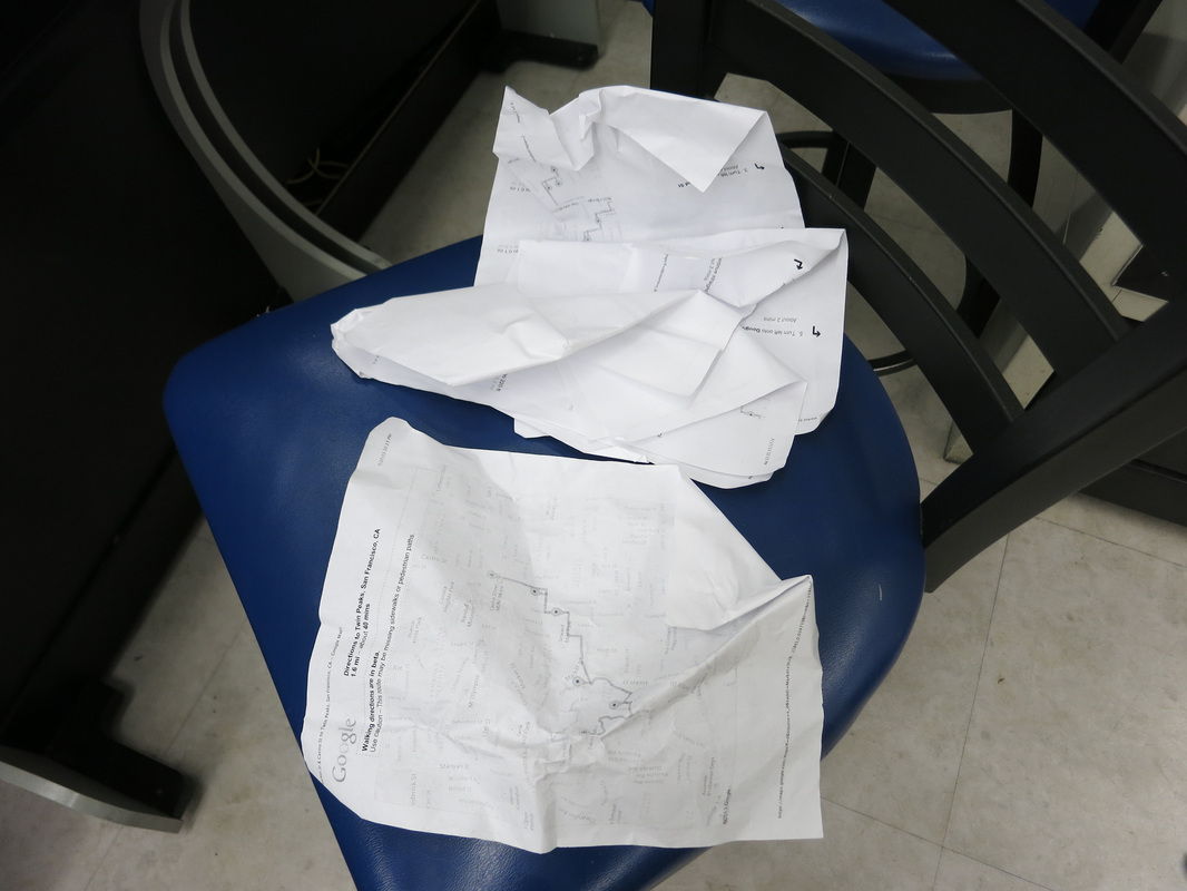
Before I write about my hike I will say how I planned it - the old-fashioned way. I pledged to not navigate with an iPhone and instead relied solely on a map I had printed out:
Time Spent Traveling: 8 hours
Mode of Transportation: Mostly walking, and public light rails and buses
Activity Level: Uphill hike strenuous at times, large amount of walking
Tour Operator: None
Before I write about my hike I will say how I planned it - the old-fashioned way. I pledged to not navigate with an iPhone and instead relied solely on a map I had printed out:
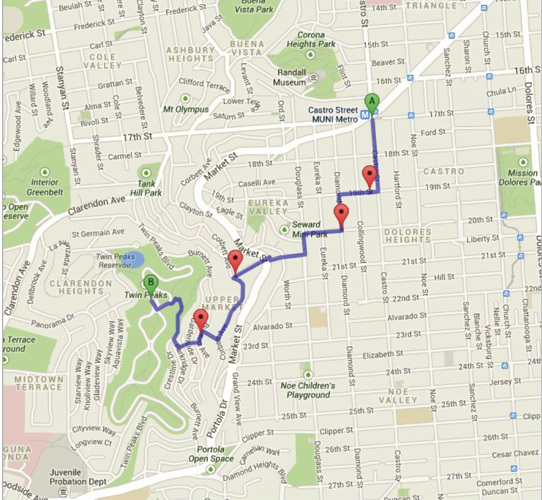
Up until that last red pin before the Twin Peaks destination, I pretty much followed this map to a T. As I got closer, the map became confusing and I resorted to following road signs to the summit. When in doubt I walked "up" because that's usually where a summit is. There were times when I felt lost and wanted to navigate with my iPhone, but I was committed to using only the map and resisted the urge.
ITINERARY (times are approximate and meant to only roughly illustrate the pace)
1.) Lunch at The Sausage Factory (12:30-1pm)
The Sausage Factory: 517 Castro Street San Francisco, California 94114 415-626-1250
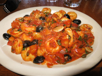
I arrived at Castro MUNI station, accessible by the L, M, or K MUNI Metro light rail lines, to begin my hike in the Castro neighborhood. The MUNI 33 bus actually drops off closer to the Twin Peaks, at Market and Clayton Streets, but it's not as convenient as the MUNI light rail system. Castro is a fun neighborhood to see, being the largest gay neighborhood in the United States and a prominent symbol for LGBT activism. Market and Clayton Street also seemed like a residential area from Google street view, and I was planning to eat lunch before hiking. Castro has a few dining options and I chose The Sausage Factory, since it was a short walk from the Castro MUNI station down Castro Street. The Sausage Factory serves Italian cuisine and I enjoyed a tasty Tortellini at Basilico dish. It had a generous amount of olives, which is always a positive in my book.
ITINERARY (times are approximate and meant to only roughly illustrate the pace)
1.) Lunch at The Sausage Factory (12:30-1pm)
The Sausage Factory: 517 Castro Street San Francisco, California 94114 415-626-1250
I arrived at Castro MUNI station, accessible by the L, M, or K MUNI Metro light rail lines, to begin my hike in the Castro neighborhood. The MUNI 33 bus actually drops off closer to the Twin Peaks, at Market and Clayton Streets, but it's not as convenient as the MUNI light rail system. Castro is a fun neighborhood to see, being the largest gay neighborhood in the United States and a prominent symbol for LGBT activism. Market and Clayton Street also seemed like a residential area from Google street view, and I was planning to eat lunch before hiking. Castro has a few dining options and I chose The Sausage Factory, since it was a short walk from the Castro MUNI station down Castro Street. The Sausage Factory serves Italian cuisine and I enjoyed a tasty Tortellini at Basilico dish. It had a generous amount of olives, which is always a positive in my book.
2.) Roundtrip Hike from Castro to Twin Peaks (1-3:25pm)
Harvey Milk Civil Rights Academy: 4235 19th Street San Francisco, CA 94114
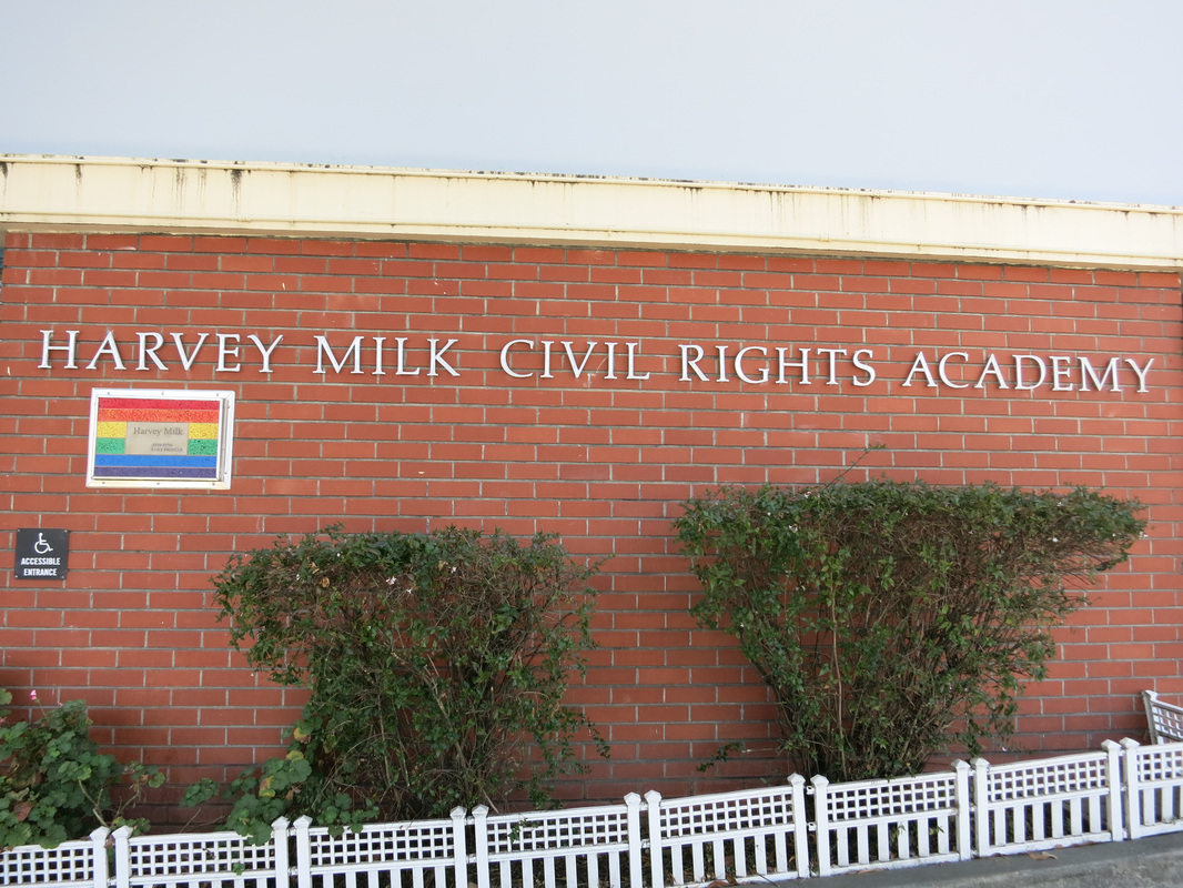
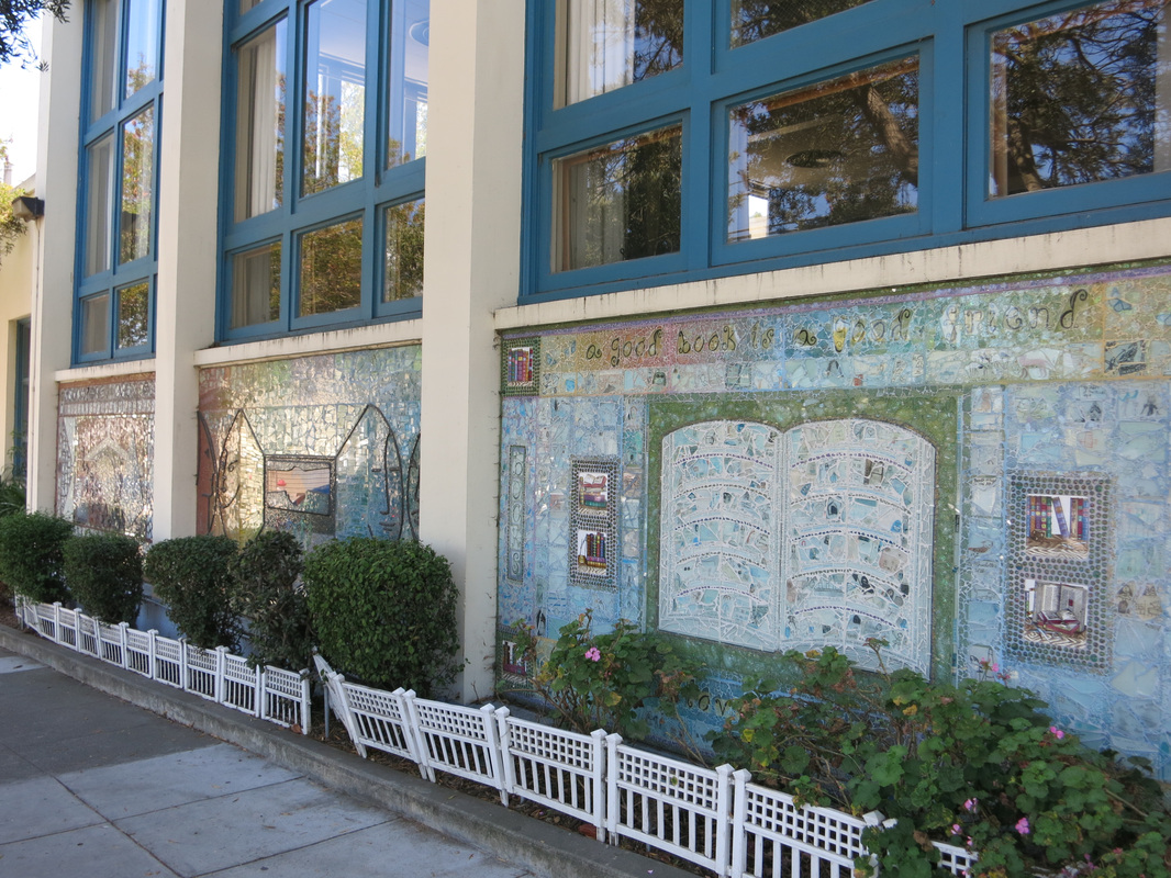
After lunch I began hiking toward the Twin Peaks, and saw the Harvey Milk Civil Rights Academy as I turned onto 19th Street. This is an alternative elementary school, named after Harvey Milk and bearing murals that honor his work. He was the first openly gay person to be elected to public office, actively fought for gay rights as a San Francisco Board of Supervisors member, and became a martyr for gay rights upon his assassination.

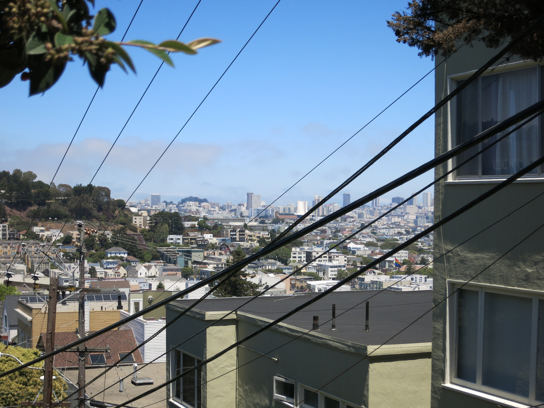
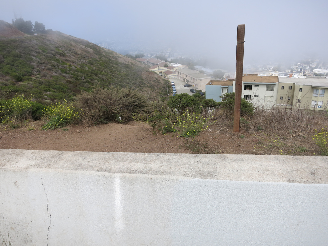
From there it was walking through some residential areas, with the uphill climbs becoming noticeable - keep in mind this is a hike to the second highest point in San Francisco. The map had me turn left on Douglas Street from 20th Street, which caused some minor confusion - Turning left meant going up the stairs for pedestrians, cars can only turn right. I looked back as I ascended the stairs and got a nice view of San Francisco, even if through electric wires.

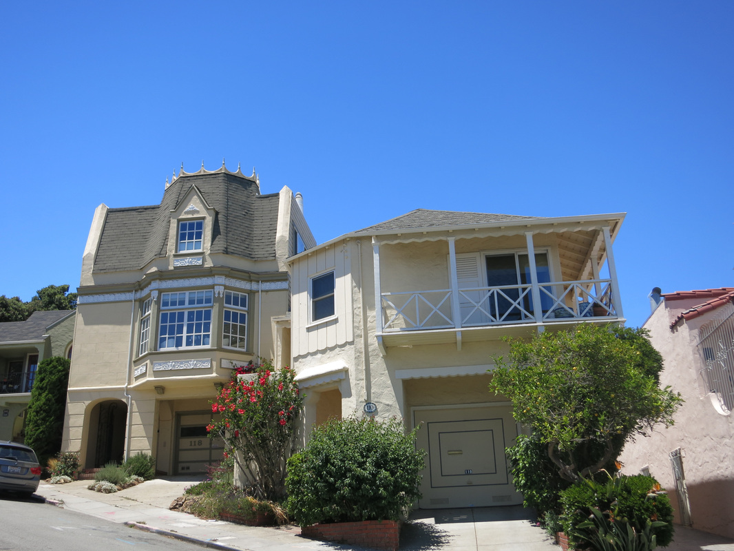
It was indeed Douglas Street at the top of the stairs but I nearly got lost again. The map says to turn right onto Romain Street - not labeled in the map above but I had a list of directions - which is a set of stairs from Douglas Street and easy to miss if you're on the other side of the road. Once I climbed the stairs and got onto Romain Street, a house that seemed to have a crown caught my attention. Looking over my shoulder, there were also some nice views of San Francisco Bay down the hill.


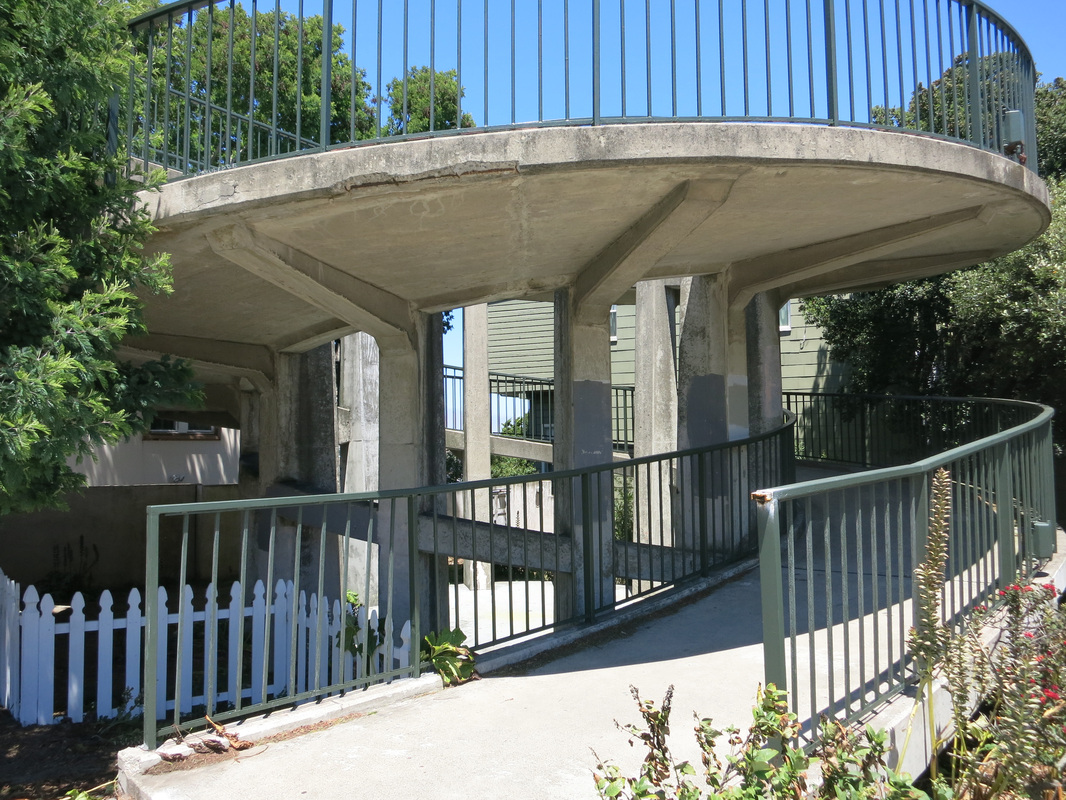
Romain Street intersects Market Street, where there is a pedestrian overpass. I went up the spiraling structure to the get to the overpass bridge, from which there were some amazing views of the city. This is also about the halfway point of the hike, although the uphill steepness plus cold, fog, and wind ramp up from here. It took me about 30 minutes to get here from Castro (1:30pm when I got to the bridge).

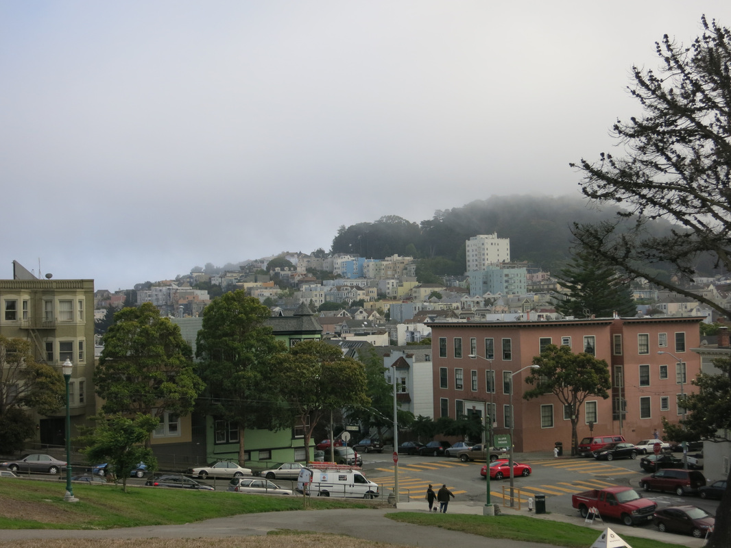
Once I crossed Market Street, there were some pretty houses on Romain Street and nice views behind me. I could also see a hill in front of me, and the fog covering it was a warning sign of what was to come...
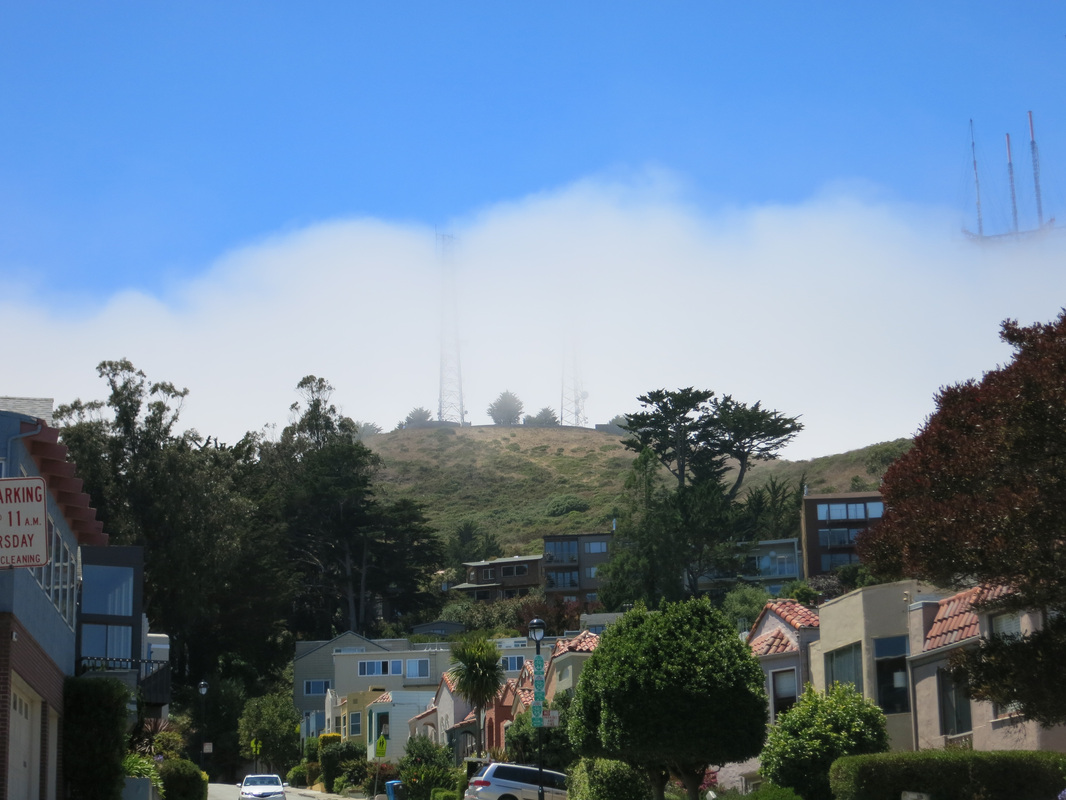
From Romain Street I turned left onto Corbett Avenue, where the wind really started picking up, and I could see the fog moving quickly above me. The wind was so strong that my map - 7 pages containing the step-by-step instructions plus the big map posted above - suddenly flew out of my hands! I chased it down and managed to salvage 3 or 4 pages, while a man who was nearby kindly fetched the other pages for me. My map was certainly a mess now; for pictures, keep reading until the part where I recycled it.
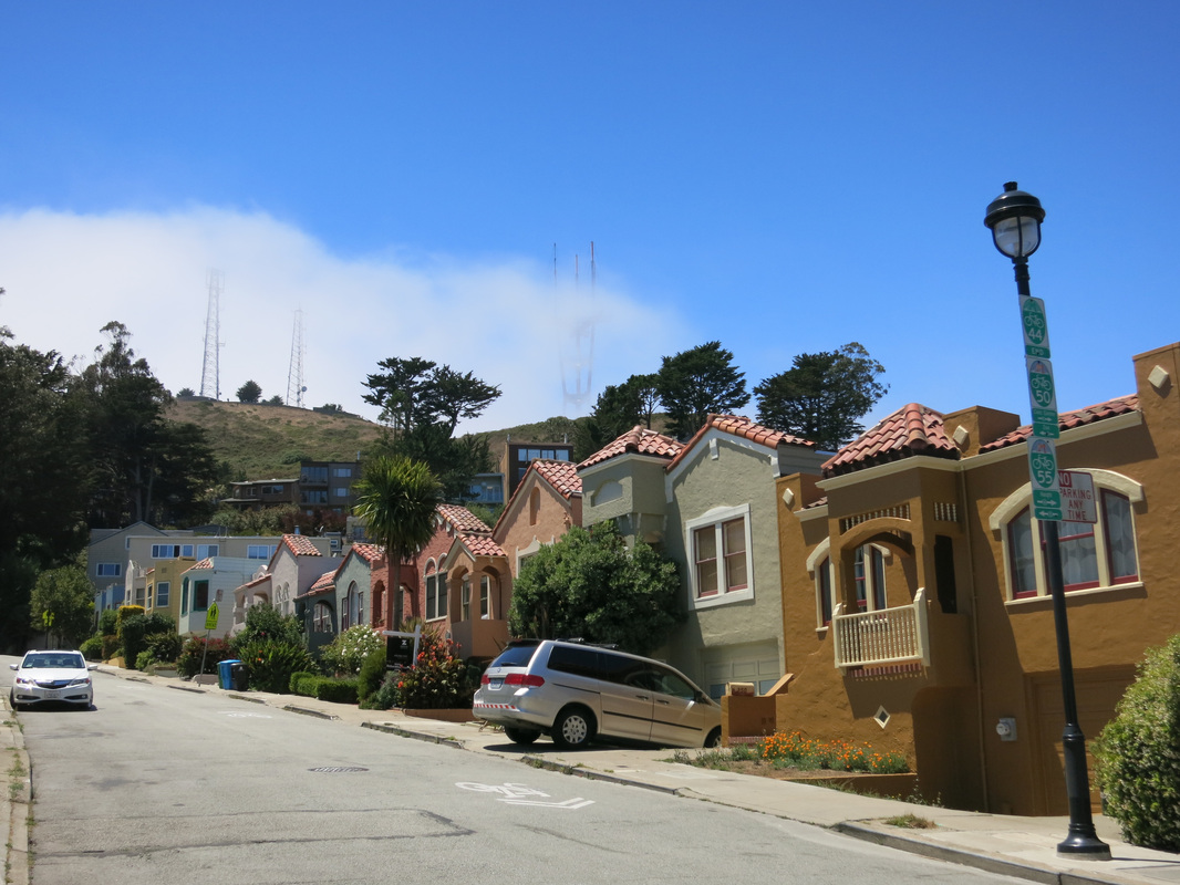
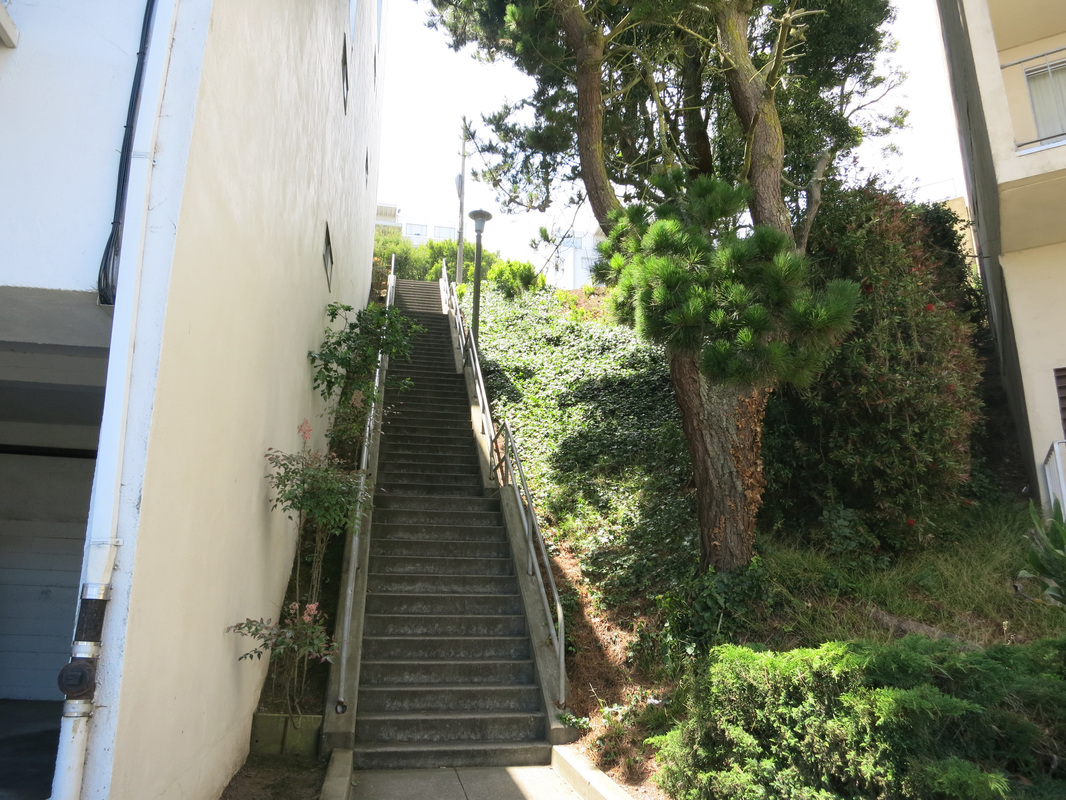
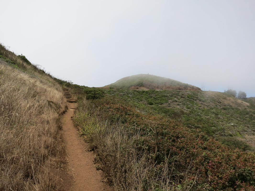
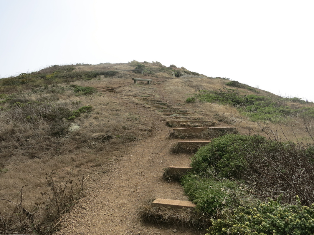
After making a right on Hopkins Ave and a left on Burnett Ave, my map started to become unhelpful. Looking back on Google maps now, I can see that the map wasn't wrong, just not detailed enough unless you zoom in more. I was meant to turn right onto Vista Lane and I *think* the pictures below are it. It's basically a pretty long flight of stairs, passing (if I remember correctly) one street and two backstreets. Don't stop until there are no more stairs, and at this point, the hill should be to your right (right picture).
After making a right on Hopkins Ave and a left on Burnett Ave, my map started to become unhelpful. Looking back on Google maps now, I can see that the map wasn't wrong, just not detailed enough unless you zoom in more. I was meant to turn right onto Vista Lane and I *think* the pictures below are it. It's basically a pretty long flight of stairs, passing (if I remember correctly) one street and two backstreets. Don't stop until there are no more stairs, and at this point, the hill should be to your right (right picture).
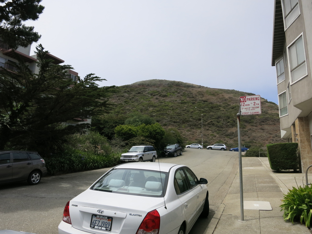
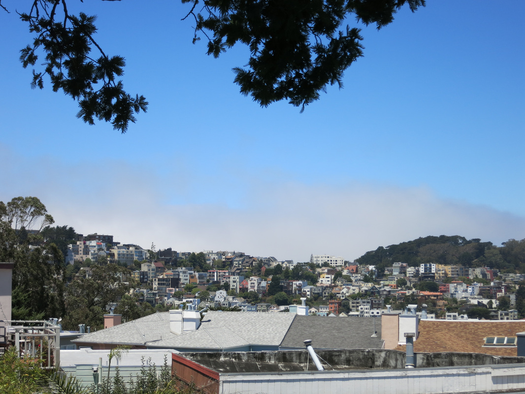
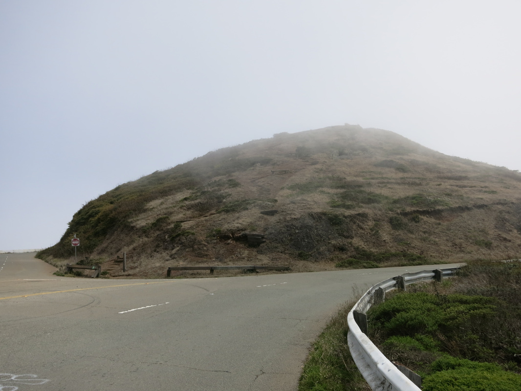
Just before approaching the hill to hike to the Twin Peaks, I took some shots of the city. Comparing these pictures to the previous ones in this post, it should be pretty obvious that I was hiking into the fog...

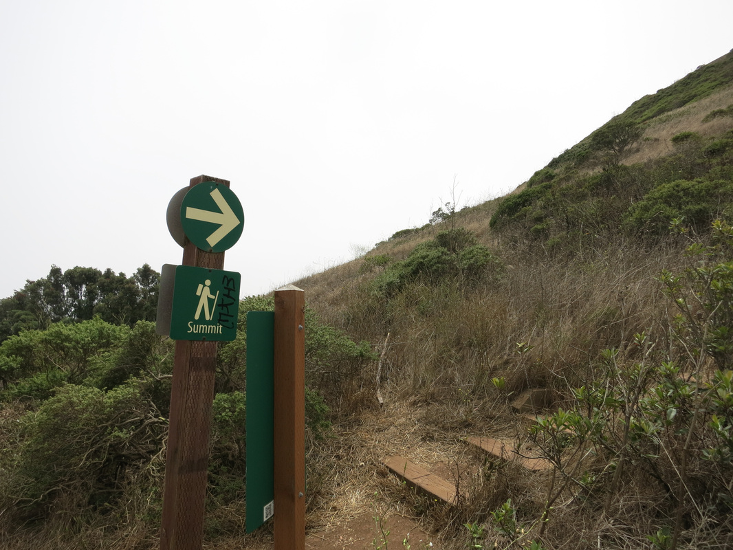
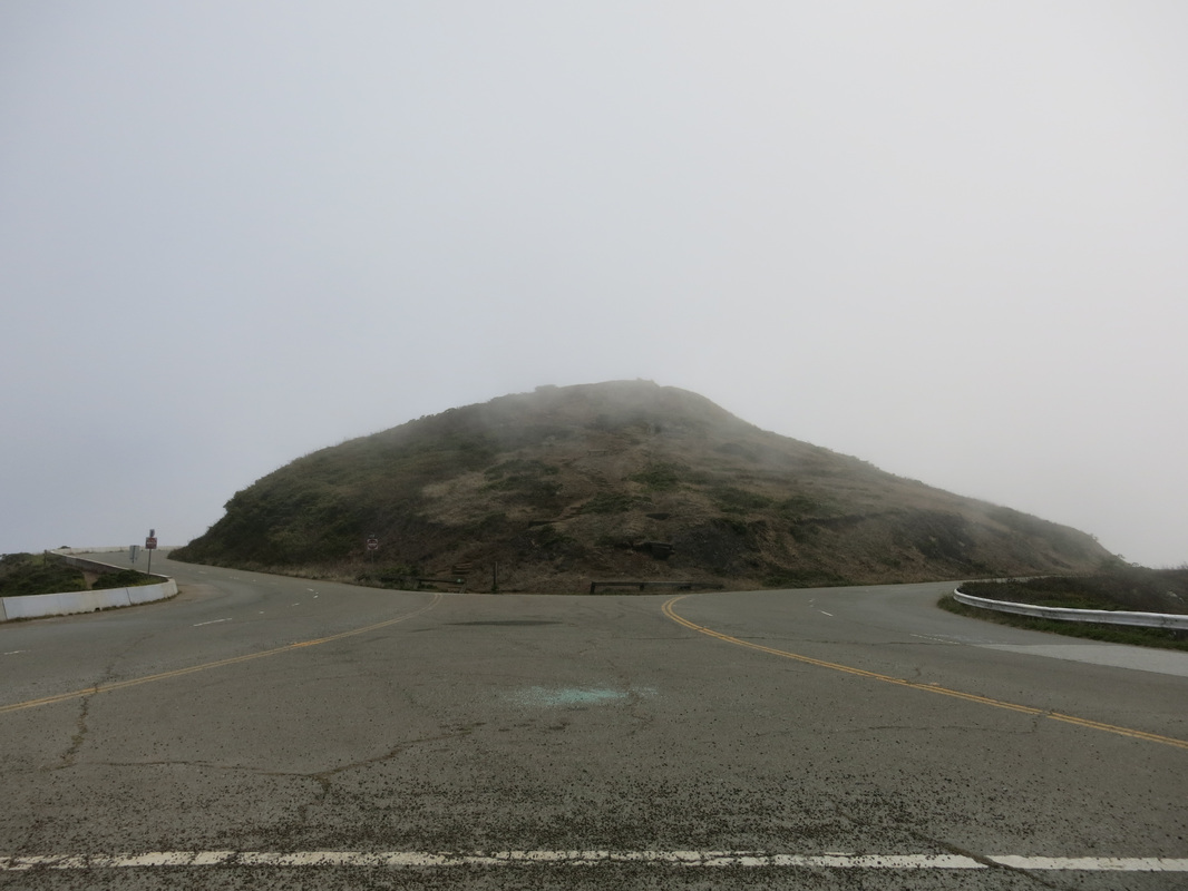
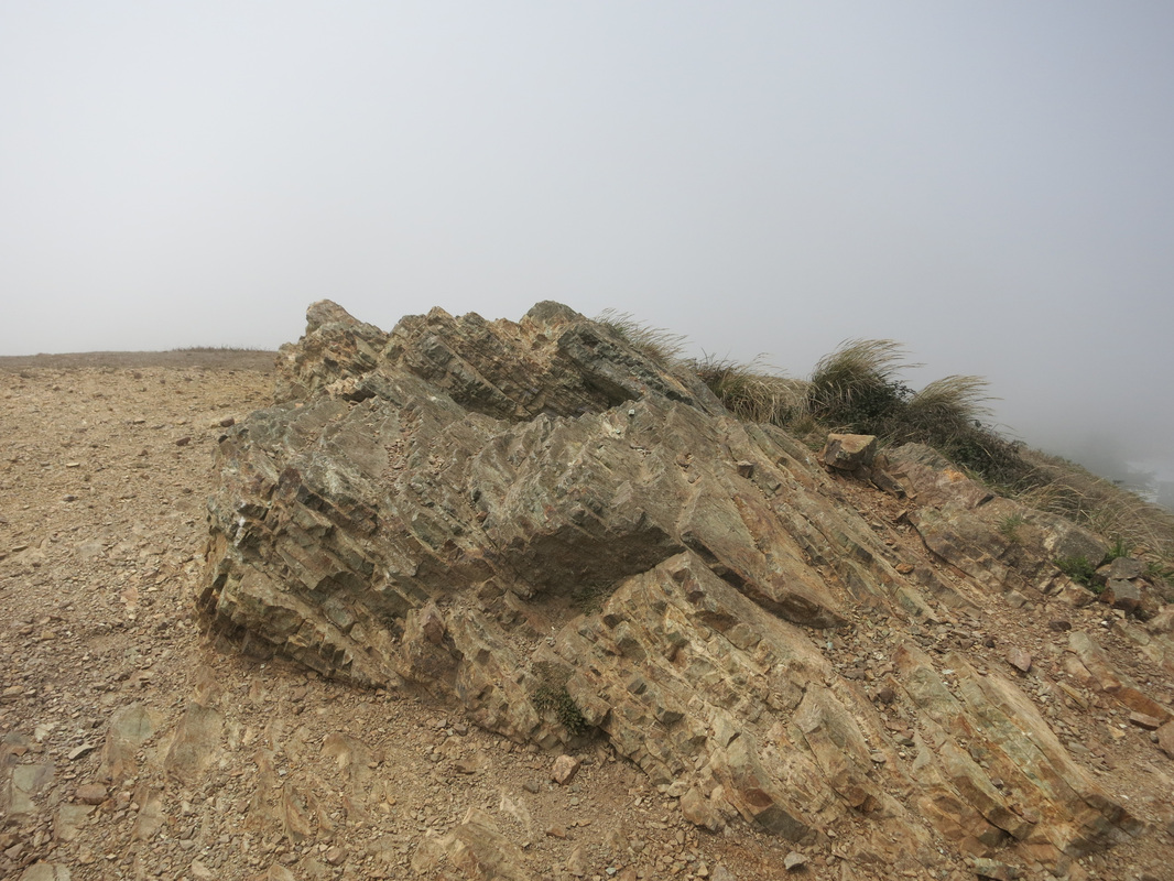
Not using my map anymore, I simply walked around the hill until I found a trail with a "summit" sign. The trail ended rather abruptly with a highway barrier to jump over, after which the Twin Peaks were in front of me.

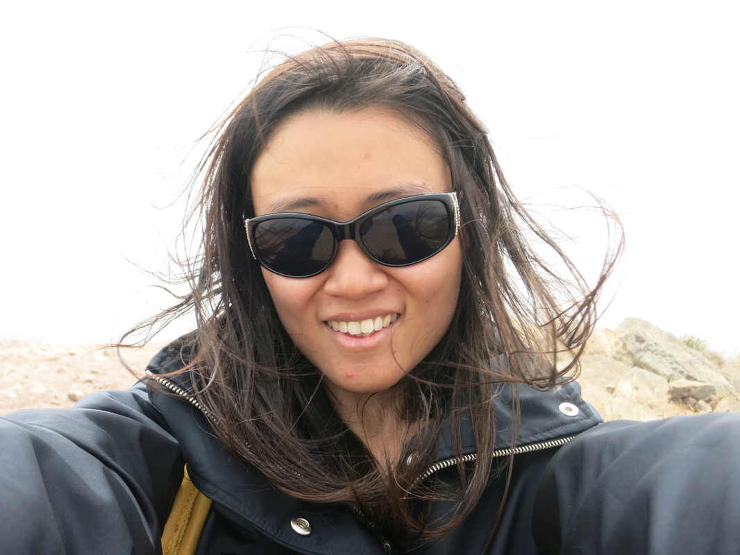
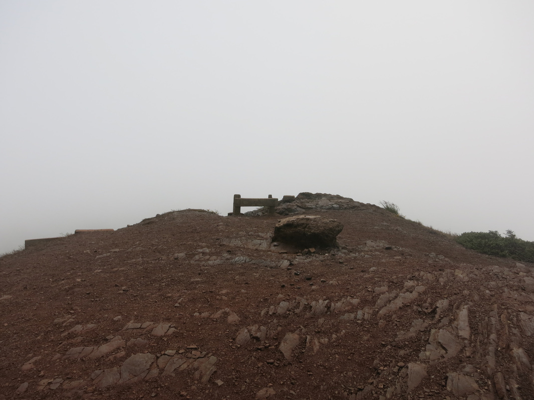
After hopping over that highway barrier, I saw two hills in front of me and was confused about which one to climb...until I remembered I was at the TWIN peaks. I chose the one in front of me and hiked to the top where I was greeted by EXTREMELY thick fog. I could not see the edge of the hill and wondered how steep it was...but did not try to find out. To add to the fog there were extremely strong winds, so I felt a bit cold, and my hair soon became a tangled mess. I took a selfie while standing in the fog and wind, certainly not my best picture with that erratic hair, but I think a girl ought to be proud of her "less-than-perfect-but-candid" moments too.
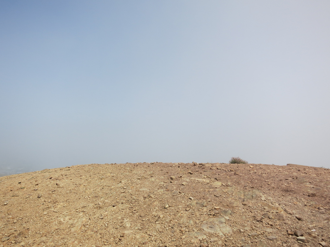
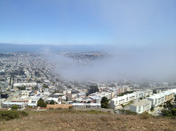
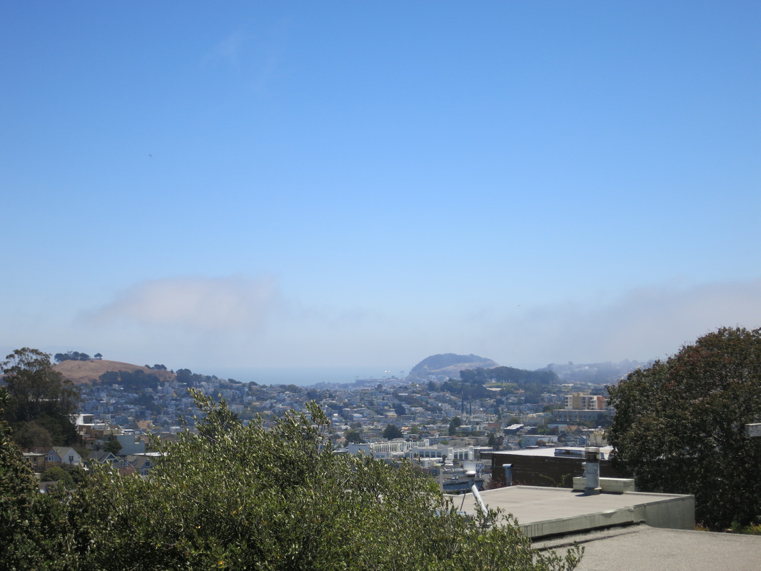
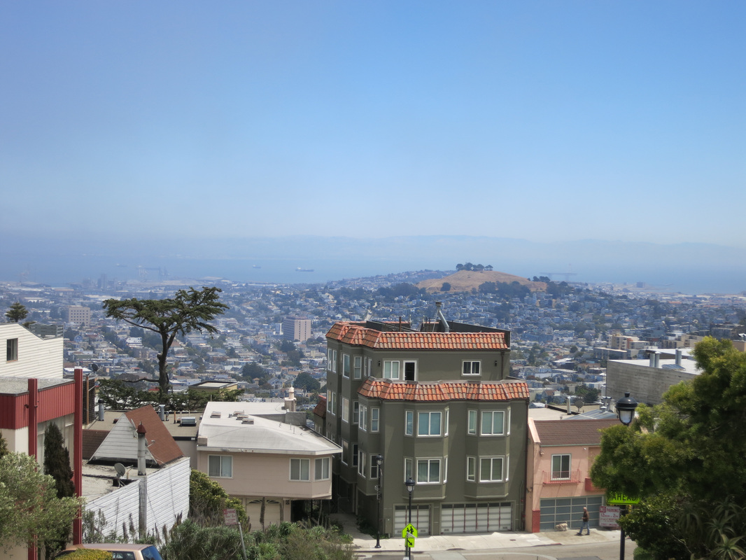
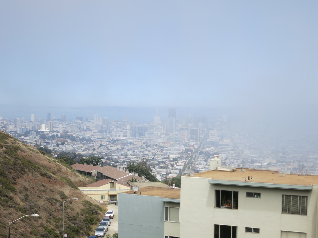
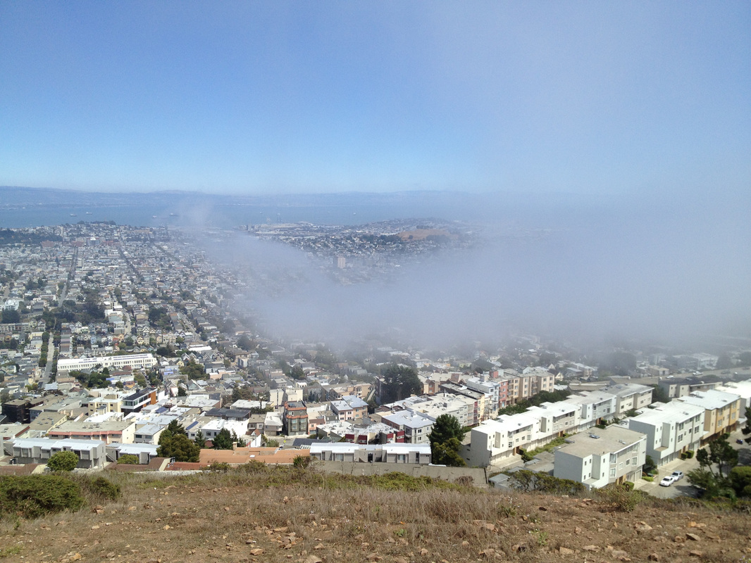
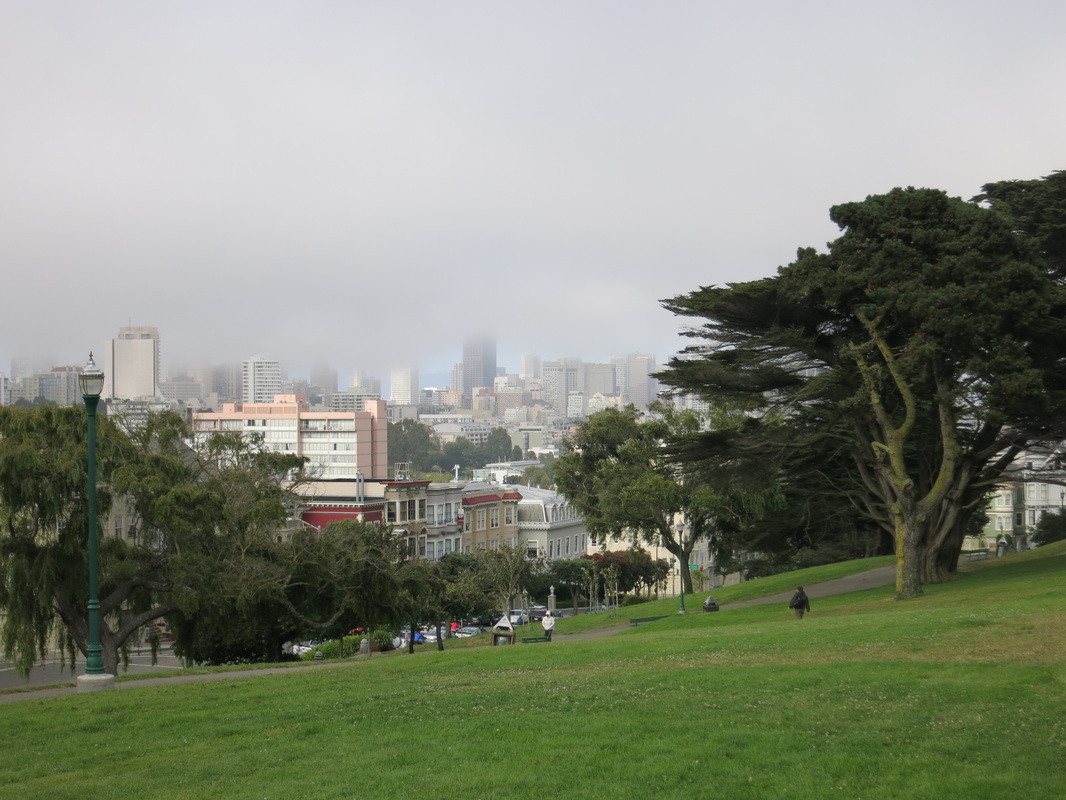
I hung out at the summit of this Twin Peak for about 30 minutes, hoping the fog would clear, and my efforts were somewhat rewarded. The fog never cleared, but there were momentary bouts of clearness during which I got some photos. Partially foggy pictures, with part of the city obscured and part of it visible, were kind of cool.
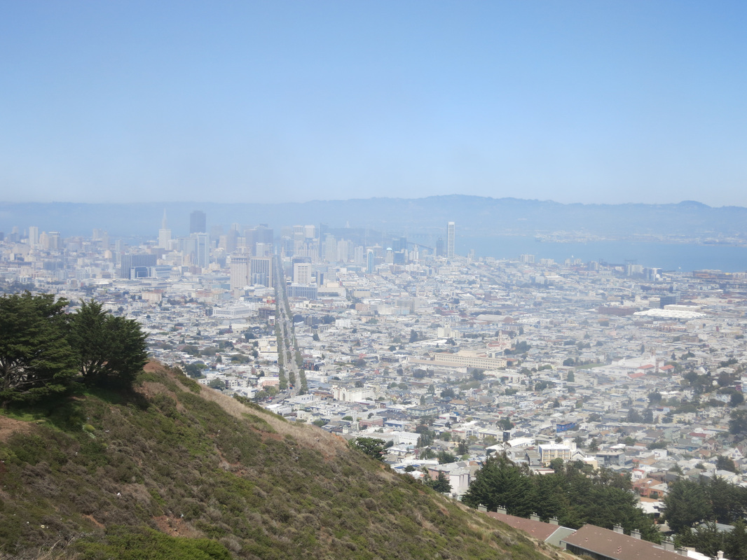


All pictures above were taken looking toward San Francisco Bay, so thinking logically: The Twin Peaks are near the geographical center of San Francisco, so the Pacific Ocean and Golden Gate Park must have been behind me. I didn't really think to look though because 1.) The fog was coming from that direction as it comes from the Pacific Ocean, and 2.) The wind was also coming from that direction and I really didn't want to turn my face toward it. I have no idea what the view is like facing that way - just an idea for those who are lucky enough to catch a clear day.
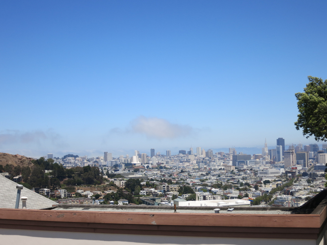
After 30 minutes in the cold, wind, and fog, I decided I'd had enough and descended the hill. I climbed the other hill just so I could say I hiked the TWIN peaks. I didn't stay too long, just took some foggy pictures on the way up and at the top.
After 30 minutes in the cold, wind, and fog, I decided I'd had enough and descended the hill. I climbed the other hill just so I could say I hiked the TWIN peaks. I didn't stay too long, just took some foggy pictures on the way up and at the top.

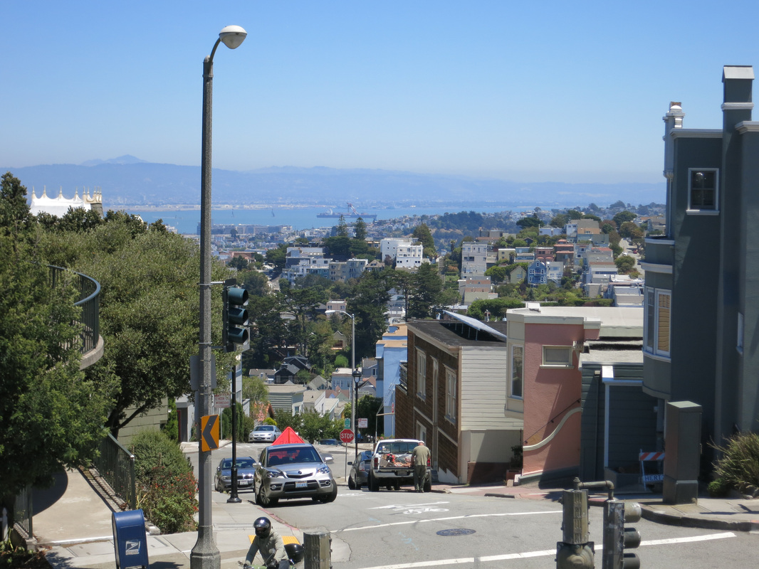
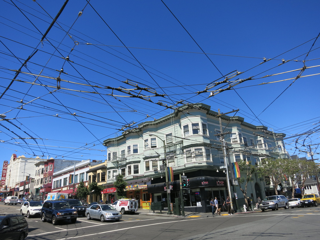
And with that I started walking back to Castro, a much easier downhill walk that took a little over 30 minutes. When I arrived I went to Walgreens for a bottle of water, and asked if they had a paper recycling bin. The Pharmacy did, and took my maps that were beaten and crinkled from the wind. I took some pictures of Castro, where gay pride symbols are prominently displayed, and I particularly noticed the mesh of electric bus wires.

3.) Bi-Rite Creamery (3:50-4:15pm)
Bi-Rite Creamery: 3692 18th St San Francisco, CA 94110 (415) 626-5600
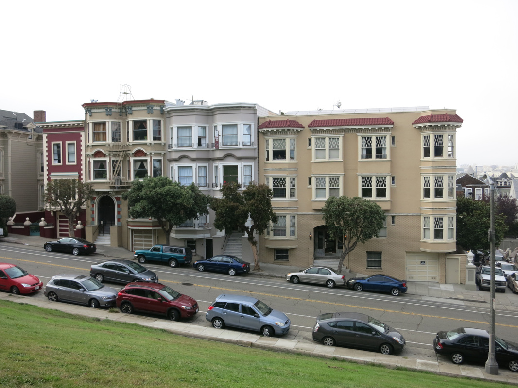
Dolores Park is a 15-20 minute walk from Castro, about 4 blocks down 18th Street - you can see Dolores Park on the map of my hike above. I walked there for Bi-Rite Creamery, which had the expected long lines, and got my usual salted caramel ice cream (the famous one) plus one other flavor (brown sugar this time). I've been here a few times so didn't bother taking pictures; for more stories on Bi-Rite Creamery and Dolores Park, see this post.
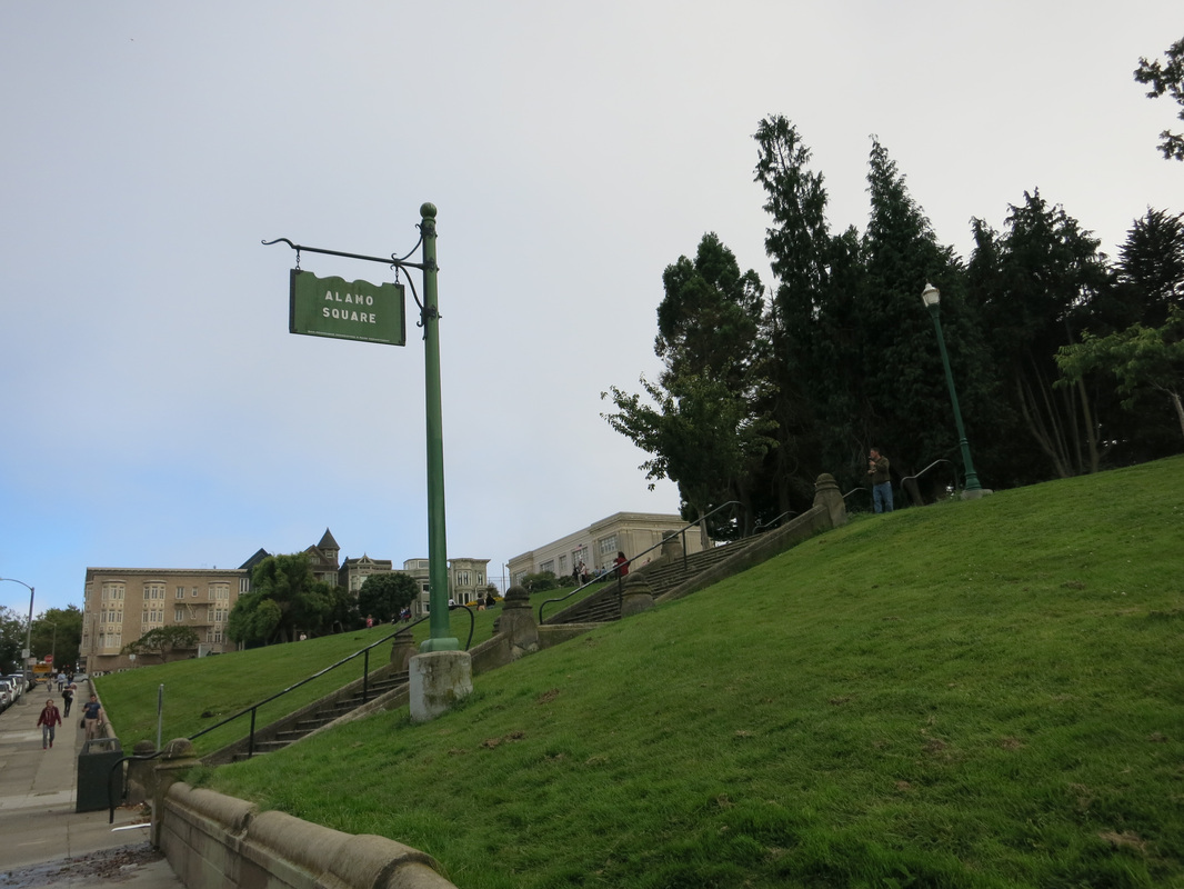
4.) Alamo Square Park (5:50-6:10pm)
After Bi-Rite Creamery I caught the MUNI J back to Embarcadero Station and went to the Ferry Building. I was planning the next day's adventures wanted to see the ferry schedule for Angel Island. When I got done with that, I caught the MUNI 21 bus near Embarcadero Station to go to Alamo Square Park via Hayes Street. I had dinner plans nearby later that evening, so decided to go photograph The Painted Ladies but also the other (less famous) houses around the park. As I said in this post, I think the other houses are just are beautiful, if not more, than The Painted Ladies.
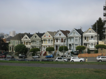
First, an obligatory picture of the famous Painted Ladies, which appeared in the popular TV show Full House:
Bi-Rite Creamery: 3692 18th St San Francisco, CA 94110 (415) 626-5600
Dolores Park is a 15-20 minute walk from Castro, about 4 blocks down 18th Street - you can see Dolores Park on the map of my hike above. I walked there for Bi-Rite Creamery, which had the expected long lines, and got my usual salted caramel ice cream (the famous one) plus one other flavor (brown sugar this time). I've been here a few times so didn't bother taking pictures; for more stories on Bi-Rite Creamery and Dolores Park, see this post.
4.) Alamo Square Park (5:50-6:10pm)
After Bi-Rite Creamery I caught the MUNI J back to Embarcadero Station and went to the Ferry Building. I was planning the next day's adventures wanted to see the ferry schedule for Angel Island. When I got done with that, I caught the MUNI 21 bus near Embarcadero Station to go to Alamo Square Park via Hayes Street. I had dinner plans nearby later that evening, so decided to go photograph The Painted Ladies but also the other (less famous) houses around the park. As I said in this post, I think the other houses are just are beautiful, if not more, than The Painted Ladies.
First, an obligatory picture of the famous Painted Ladies, which appeared in the popular TV show Full House:
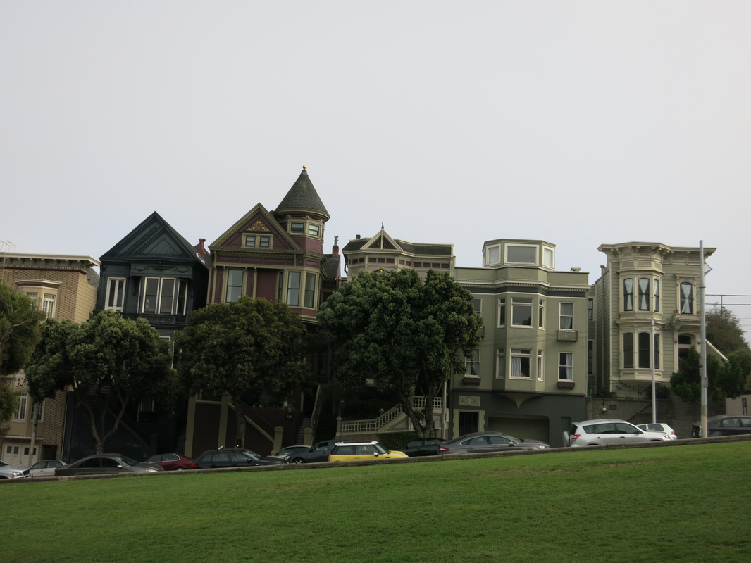
And now I present - The other houses around Alamo Square Park that never appeared in Full House but are very beautiful:
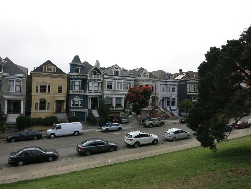

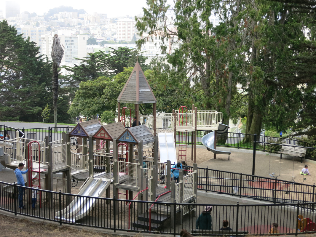
And some other pictures of Alamo Square Park. The playground had a structure shaped like the Painted Ladies...cute!
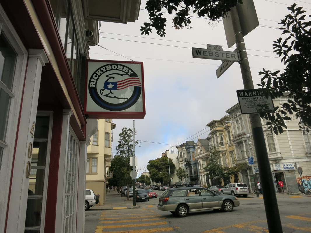
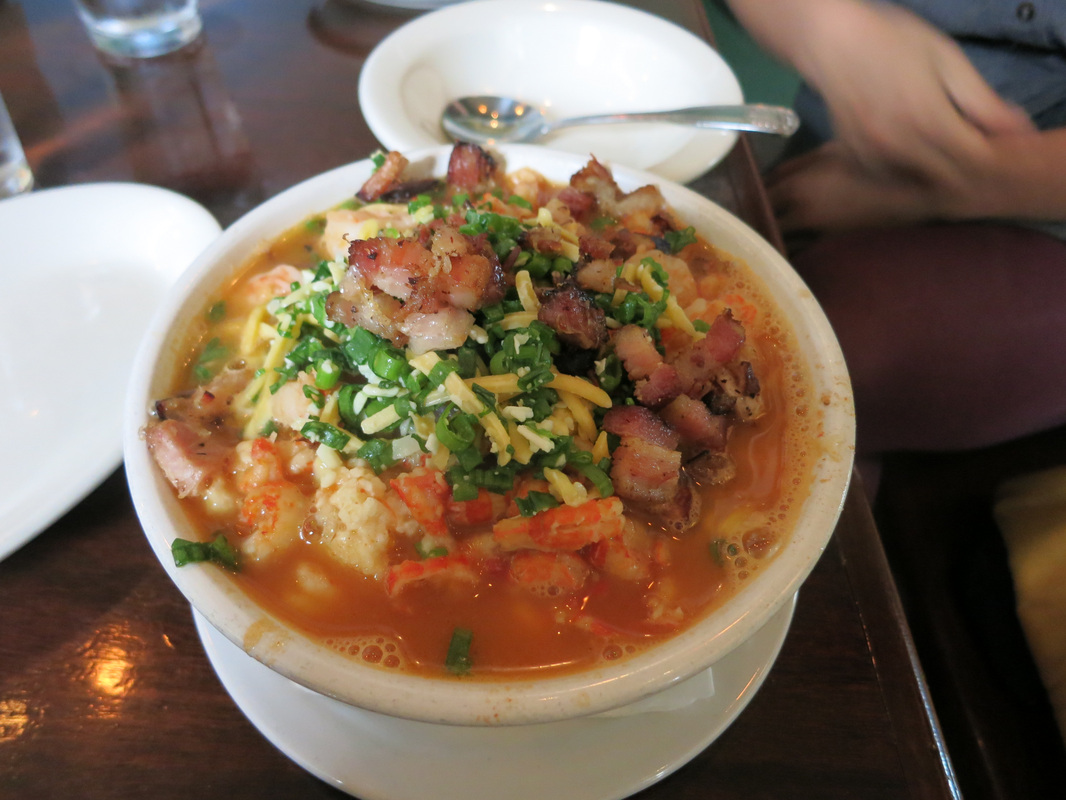
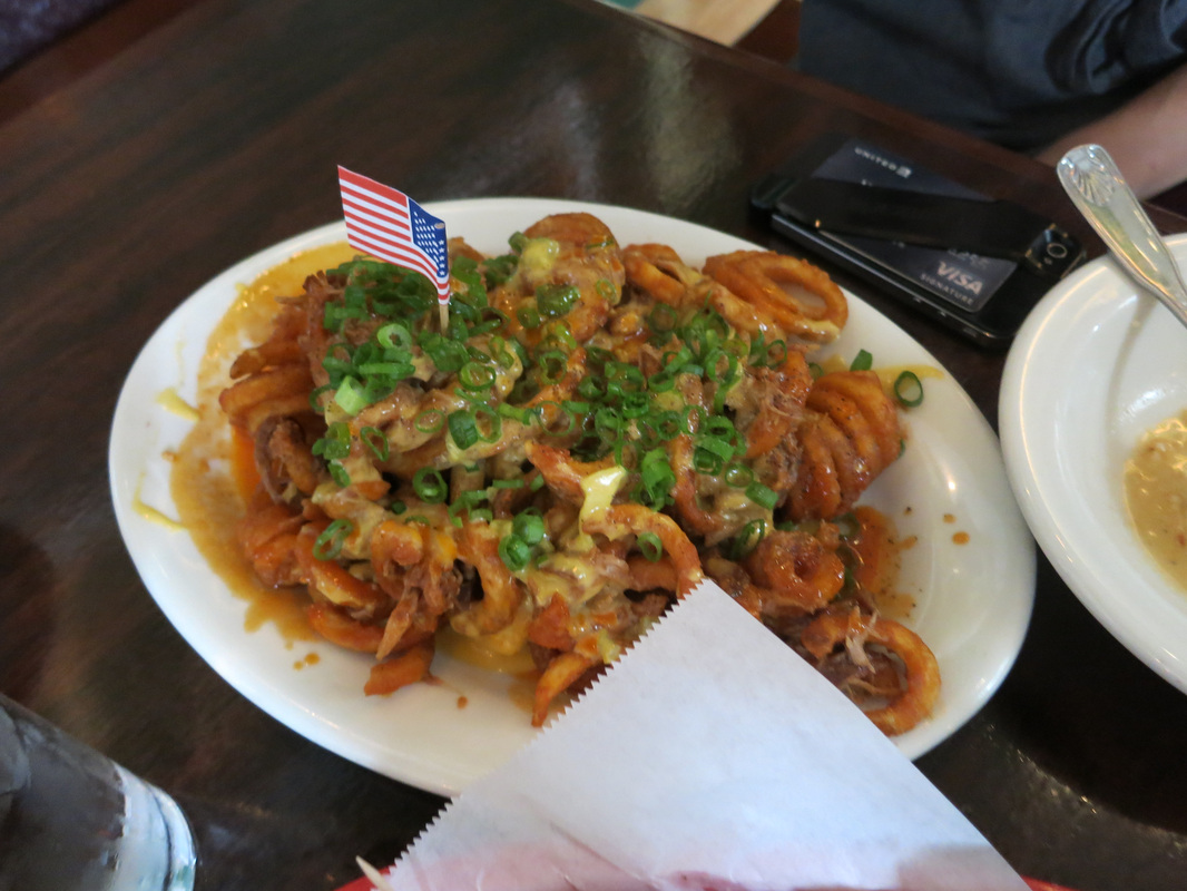
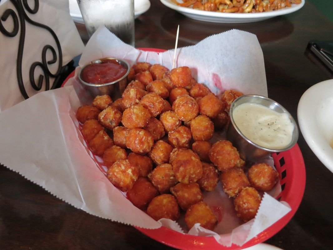
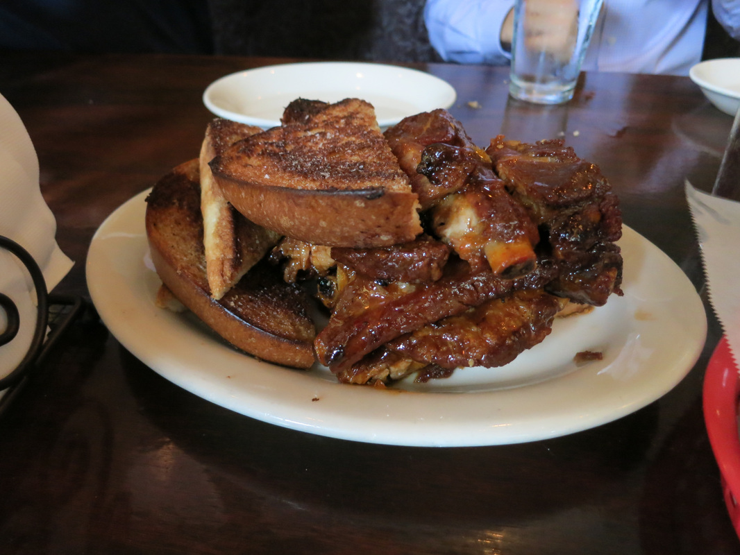
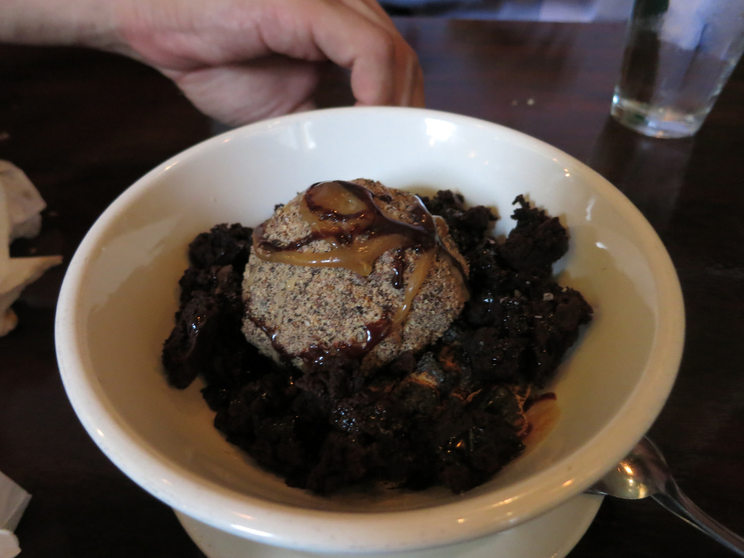
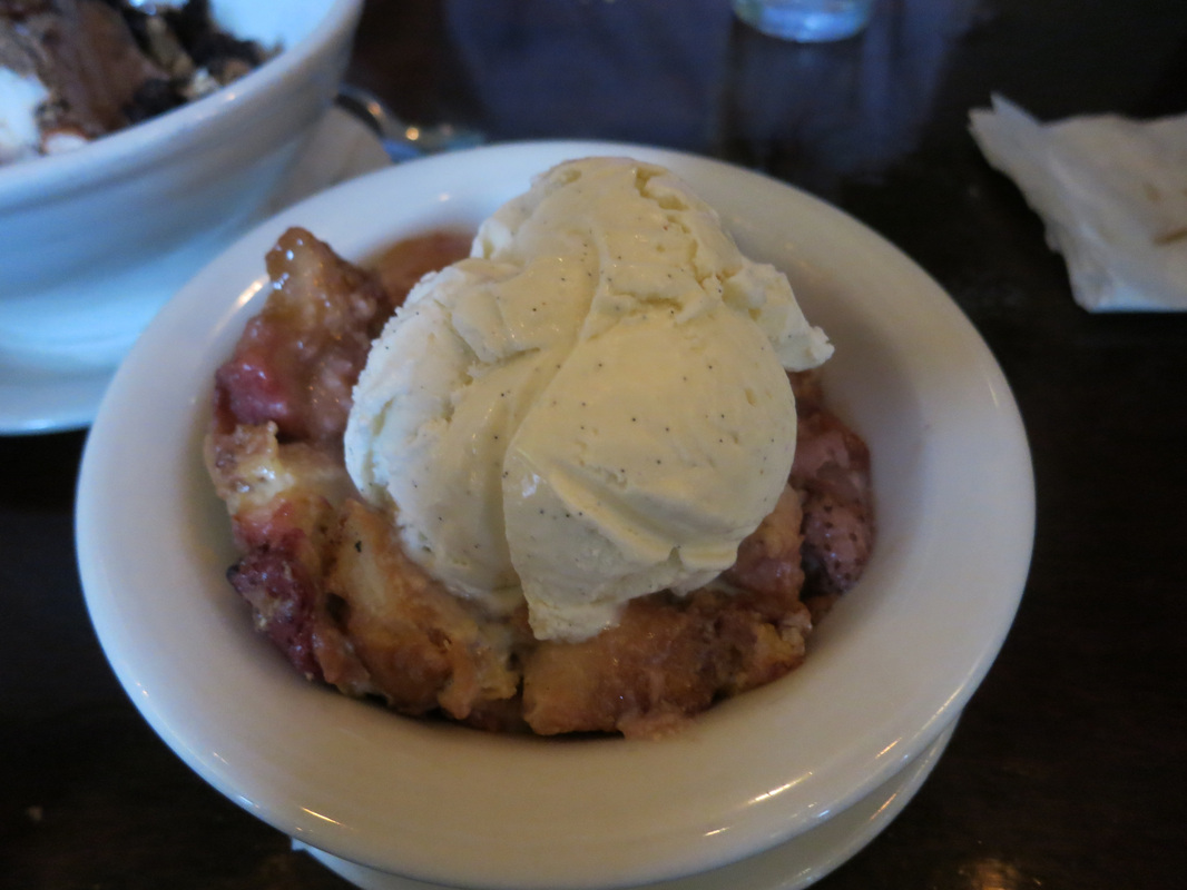
5.) Ricky Bobby Diner (6:30-8pm)
Ricky Bobby: 400 Haight St San Francisco, CA 94117
This was a short walk from Alamo Square Park and I had plans to meet some friends here. Ricky Bobby serves delicious food in a casual environment, but is definitely not the place for health nuts - I'll let the pictures below speak to that last point. Having grown up on Cajun food in New Orleans, Louisiana, I especially enjoyed the crawshrimp grits. My other favorite was the pork fries; sort of like chili cheese fries except there's tender pulled pork instead of chili. When we finished eating - $22/person with 4 people - my friends went out for drinks but I had to go home to work on a consulting project.


TIPS FOR THE HIKE TO TWIN PEAKS:
1.) I recommend bringing snacks and water just in case. I didn't and I was fine - San Francisco weather is mild so there's not a huge risk of dehydration like in other hotter places - but I did get a little thirsty from the pasta I ate for lunch. I imagine the uphill hiking may also make some people hungry.
2.) It can be cold, foggy, and windy at the top, even if it seems nice and sunny on the way to the Twin Peaks. From the pictures in this post, you can see that the fog sits at a certain elevation, and as you ascend you literally enter the fog.
3.) Don't be too upset if you get to the top and it's foggy. San Francisco is fog; fog is San Francisco; it's just the nature of the city's geographical location. If you wait around like I did, it will probably clear for a few minutes (eh, seconds), and you can quickly snap a picture.
4.) Women with long hair, I recommend you pull it back so it doesn't fly in the wind, unless you want it to look like mine did in that selfie I posted above.
 RSS Feed